Winter weather changes on a dime in Saskatchewan. (Image Credit: Cam Lee/northeastNOW)
Gradual warming trend next week
Snow squall watch in effect; March not coming in like a lion this year
Feb 26, 2026 | 12:24 PM
-
Share on Facebook
-
Share on Bluesky
-
Share on X
- Copy Link
Brief but intense bands of snow are expected this evening over west central Saskatchewan.
Snow squall bands will develop later this evening and track southeastward over Lloydminster, Kindersley, Battlefords, Meadow Lake, Prince Albert and Saskatoon, but La Ronge and Melfort both fall just out of the snow squall watch area issued by Environment Canada.
The squalls could reduce visibility to near zero at times in snow and blowing snow as winds gust up to 80 km/h. Conditions will improve overnight. Travel may be hazardous, so check the Highway Hotline before heading out.
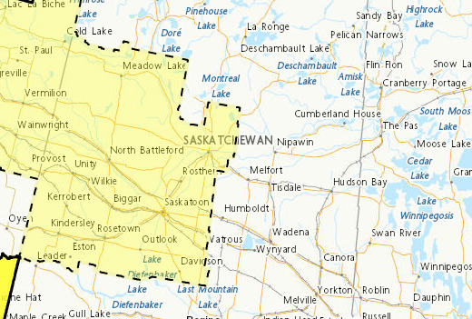
Environment Canada issued a Snow Squall Watch advisory Thursday afternoon for the areas highlighted in yellow. (Image Credit: Screenshot/weather.gc.ca)


