Click here to sign up for our free daily newsletter
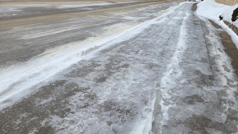
Higher temperatures and rain are leading to icy situations on roads and highways. (Cam Lee/northeastNOW)
Freeze-thaw cycle continues

Icy conditions persist due to freeze-thaw cycle

Jan 12, 2026 | 1:47 PM

The warmer weather is certainly welcomed after a cool start to winter, but there is a downside.

High temperatures are expected to be at or above freezing during the day, while being a little cooler overnight.

Environment and Climate Change Canada Meteorologist Justin Shelley said northeast and central areas could see off-and-on precipitation over the next few days, as they are on the boundary between the warmer and cooler air.

“Rain and mixed precipitation is going to continue through most of the week, until we get to Friday,” Shelley said.

The Battlefords area will see more sunshine during the week, with slightly warmer temperatures as well. The La Ronge region, much like the northeast and central regions, will have mixed precipitation and highs right around the freezing mark.

Normal daytime highs for this time of year are around –12 C to – 14 C, and all areas will see both high and low temperatures above normal. Shelley said low temperatures will dip below zero, and that freeze/thaw cycle should last most of the week.

“With the additional precipitation, compounded with the melt with the slightly above freezing temperatures, we could see those surfaces become a bit slick in the overnight and early morning hours,” Shelley said. “That will be something to be mindful of as we head out for the rest of the week.”

Shelley said road and sidewalk conditions should improve during the day as the temperatures increase, but it could get icy when the mercury drops.

Travel was not recommended for much of the northeast early Sunday as freezing rain left conditions dangerously icy.

The well above normal temperatures will stick around for a few days before dropping to more normal conditions overnight Thursday into Friday.

cam.lee@pattisonmedia.com