Click here to sign up for our free daily newsletter
The storm, which pummelled central and southern parts of the province on Wednesday, brought lots of snow, freezing rain and whipping winds along with it, leading to icy road surfaces, low visibility and several crashes. (Highway Hotline/X)
Winter Weather

Some travel advisories still in effect in Saskatchewan following major snowstorm

Dec 18, 2025 | 9:06 AM

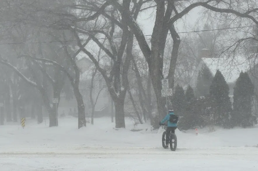
Some travel advisories were still in effect on Thursday morning after a major snowstorm blew through Saskatchewan.

The storm, which pummeled central and southern parts of the province on Wednesday, brought lots of snow, freezing rain and whipping winds along with it, leading to icy road surfaces, low visibility and several crashes. Many roads were closed on Wednesday, with some flights and classes also halted by the blizzard.

Read more:

While Environment Canada’s blizzard warnings were no longer in effect on Thursday, driving will likely still be a challenge in some areas.

The Saskatchewan Highway Hotline was recommending against travel on most highways in the southeastern corner of Saskatchewan, including highways 6, 33 and 48 southeast of Regina, and numerous routes in the Estevan, Carlyle, Grenfell, Whitewood and Moosomin areas.

Travel was also not recommended on the Trans-Canada Highway between Regina and Moose Jaw. Several highways around Watrous, Central Butte, Hodgeville, Beechy and Consul were covered under the travel advisory as well.

Saskatchewan RCMP officers responded to 82 reports of crashes around the province between 4 p.m. on Wednesday and 7 a.m. on Thursday.

Police said officers also responded to 25 weather-related traffic reports.

“These were reports of tractor-trailer units unable to drive up a hill, icy roads that need to be sanded and vehicles pulled over on the side of the road to let the weather pass,” the RCMP said in a statement, adding that the numbers don’t include stuck or abandoned vehicles that officers spotted while responding to other calls.

Police urged drivers to use caution and check the Highway Hotline before hitting the road.

“Slow down, use caution and dress warmly,” the RCMP said.

“If travel is not essential, wait until road conditions along your route improve before driving. If travel is necessary, stay on roads that have recently received road maintenance.”

According to Environment Canada’s forecast, both Regina and Saskatoon should see temperatures warming up on Thursday as the day progresses.

Saskatoon can expect a high of -20 C on Thursday, the weather service noted, followed by an overnight low of -18 C and a high of -12 C on Friday, with more snow headed to the city at the end of the week. Regina can expect a high of -23 C Thursday, followed by an overnight low of -16 C and a high of -3 C on Friday accompanied by some snow.

A cyclist rides during a blizzard in Saskatoon on Dec. 17, 2025. The blizzard on Wednesday didn’t deter this Saskatoon cyclist. (Mia Holowaychuk/650 CKOM)

Extreme cold hits northern Sask.

While the blizzard warnings have ended, large portions of northern Saskatchewan were under extreme cold warnings on Thursday morning, with Environment Canada warning of wind chills between -45 C and -50 C in the far north.

“Some communities will see conditions moderate this afternoon, but areas in the far north will likely see wind chill values near minus 45 continue into the weekend,” the weather service said in a statement.

Milder storm expected on Friday

Wednesday’s storm was unusually powerful for this time of year, according to Environment Canada meteorologist Dave Carlsen.

“It was pretty wild,” he said.

Carlsen said the storm that rolled through the province was an Alberta Clipper, which normally travel northwest to southeast.

Bringing freezing rain, snow, and wind to southern Saskatchewan, the storm looked different in many parts of the province. Southwest Saskatchewan got especially windy, Carlsen said, with the Cypress Hills recording wind speeds of 128 km/h.

Regina, meanwhile, saw wind gusts as high as 83 km/h and Saskatoon saw wind speeds of 70 km/h.

When it comes to snow, Carlsen said both Saskatoon and Regina probably got about 10 to 15 cm, but the exact amounts have not yet been confirmed through official reports.

“It was a really powerful system,” he said, noting that the storm surpassed the usual snowfall and wind speeds associated with an Alberta Clipper.

“It’s not completely out of the ordinary, but for this type of system in this time of year it was a little bit out of the normal,” Carlsen said.

While the southeast corner of Saskatchewan was still getting hit by the tail end of the storm on Thursday morning, the majority of the system has already passed into Manitoba and North Dakota.

But, Carlsen said, Alberta Clippers typically bringing multiple systems in a row, and there’s another, milder storm on the way to Saskatchewan.

“Tomorrow, we’re looking at another snowfall,” said Carlsen.

He said the storm will hit an area stretching from the Battlefords through Saskatoon, and potentially as far south as Regina.

“Tomorrow’s snowfall will be probably not as much as we just saw, and the wind won’t quite be as strong, so it’ll be more typical of a system this time of year,” Carlsen said.

The meteorologist said he expects the system will move into the province at around 6 a.m. on Friday morning, or even a little earlier, meaning the morning commute “might be a little bit dicey.”

The latest updates on weather alerts can be found on Environment Canada’s website, and current information on road conditions can be accessed through the Saskatchewan Highway Hotline.

–with files from 650 CKOM’s Marija Robinson