Battlefords area added to blizzard warning
-
Share on Facebook
-
Share on Bluesky
-
Share on X
- Copy Link
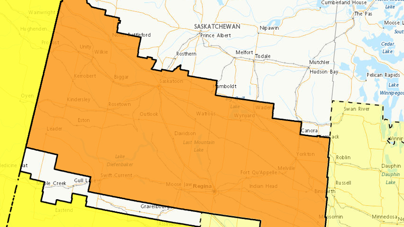
Severe weather is likely to cause significant damage, disruption, or health impacts. That’s what the colour orange means on Environment Canada weather alert maps, and there is a large swath of it covering southern and west-central Saskatchewan, including the Battlefords.
The area was added to a blizzard warning late Tuesday afternoon. Environment and Climate Change Canada said blizzard conditions with gusty winds are expected in portions of southern Saskatchewan, including the Yellowhead and Trans-Canada highway corridor. Total snowfall amounts of 10 to 20 centimetres are expected along with wind gusts up to 80 km/h. The forecast for the Battlefords suggests local snowfall amounts of 5 to 10 cms.
A strong Alberta clipper is expected to bring blizzard-like conditions on Wednesday morning through Wednesday night. Environment Canada said similar storms in the past have caused school closures and cancellations of scheduled activities, scattered utility outages and adverse driving conditions.
There is also a risk of freezing rain throughout the day on Wednesday extending from Leader and Kindersley, southeast towards Swift Current, Moose Jaw, Regina, Estevan and Broadview.