Click here to sign up for our free daily newsletter
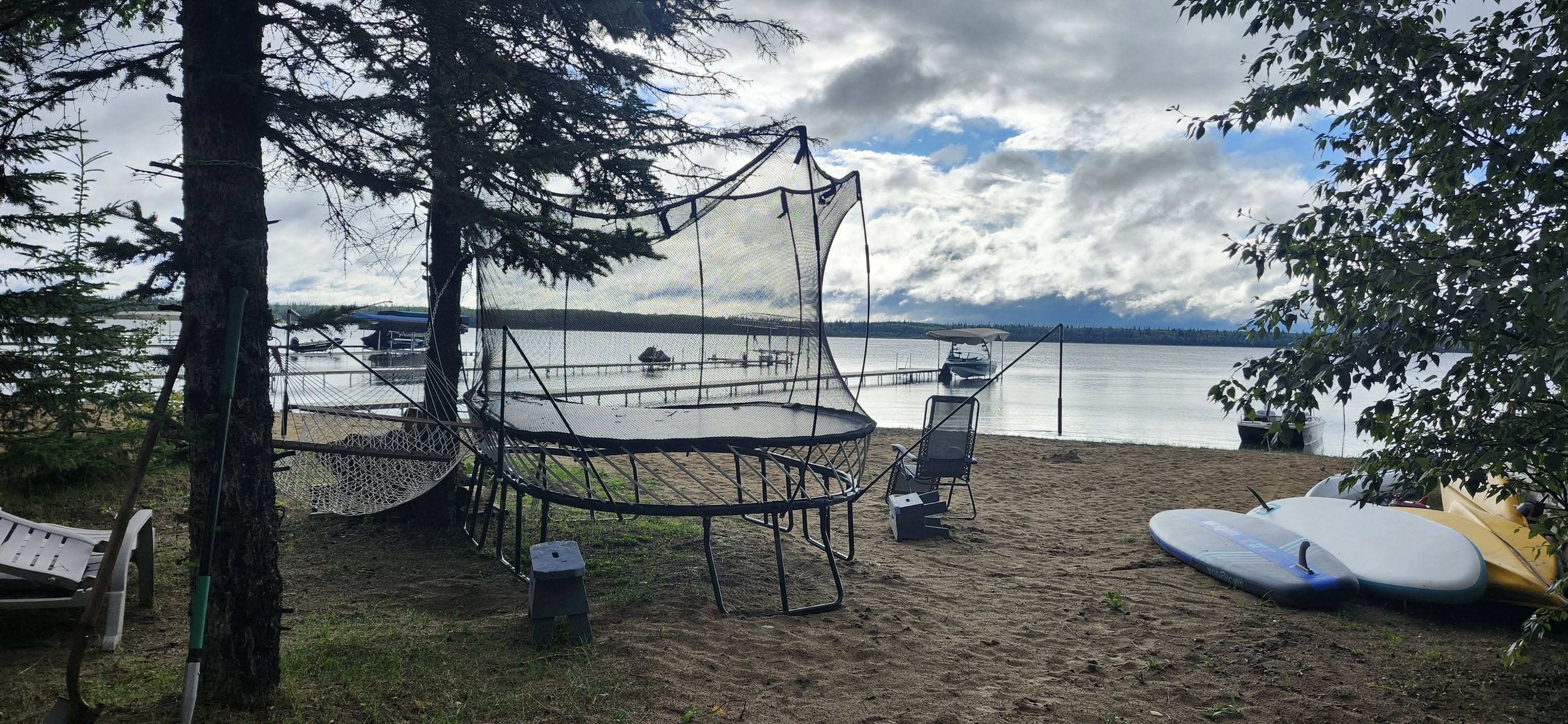
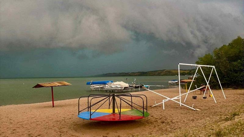
Storm clouds roll in over Jackfish Lake towards Cochin ahead of Wednesday's storm. (Photo submitted/Rob Lindsay)
Rain, hail, wind, lightning and even funnel clouds

‘Most electric storm of the year’ sees over 6,000 lightning strikes an hour

Aug 14, 2025 | 12:02 PM

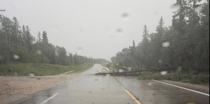
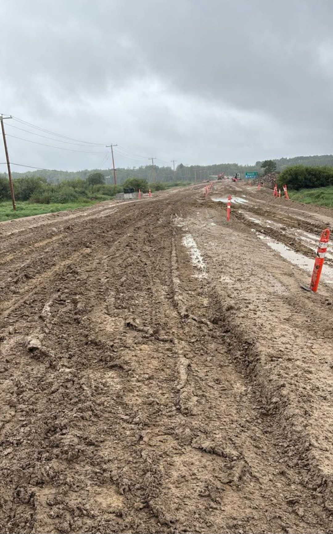
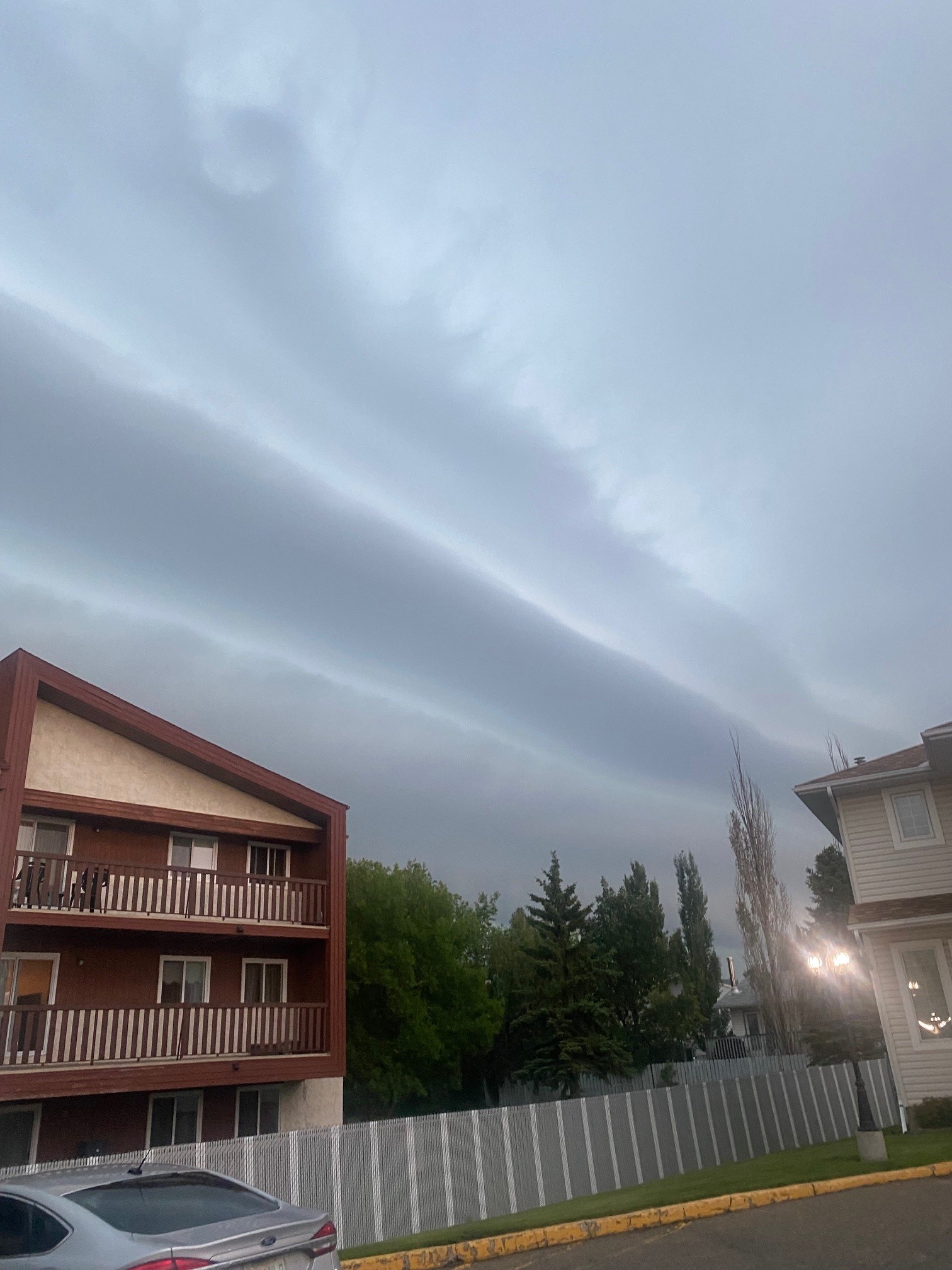
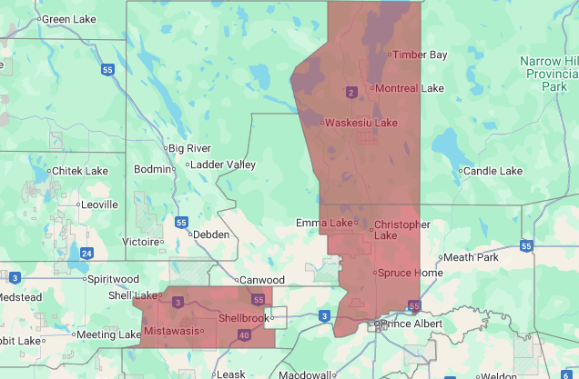
Saskatchewan got the thunderstorm of the summer for 2025 yesterday, according to Environment Canada.

Rainfall amounts over 50mm, wind speeds over 90km/h, golf ball-sized hail, funnel clouds, and even a report of a lost dog were all reported from different areas of the province as a large low pressure system swept its way from the western to eastern borders of the province.

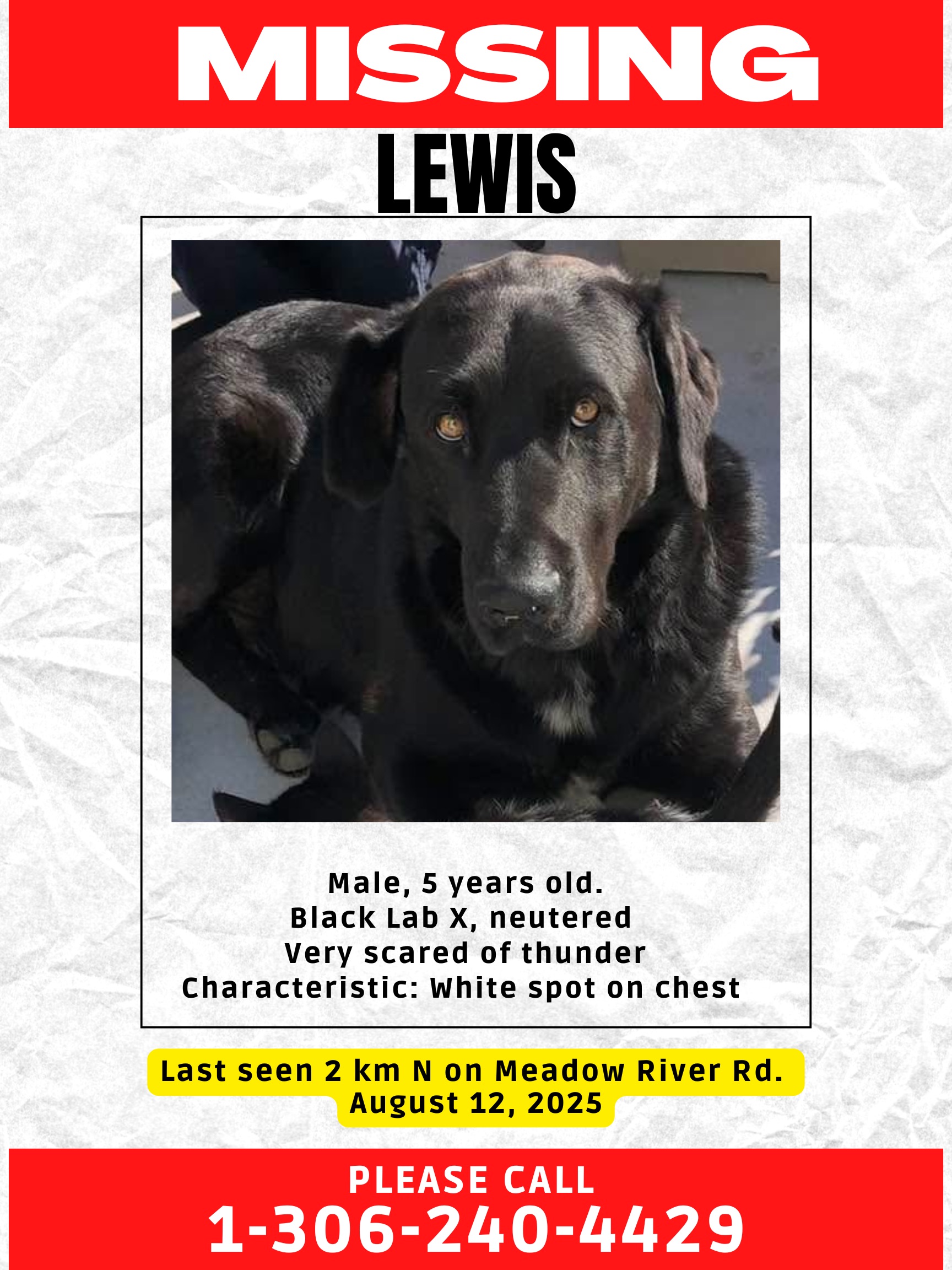
Spooked by the storm, Lewis ran away from his home in the Meadow Lake area. (Photo submitted/Judy Schroeder)

Environment Canada meteorologist Crawford Luke said they still have reports rolling in, but most of the damaging winds and hail were in the Battlefords area.

“It looks like a lot of hail around the Battlefords, up to five centimeters in diameter, so the size of like a chicken egg. Golf ball-sized hail, a few reports of that. So, that was kind of the big one there. There’s also a few funnel cloud reports near Mervin, Luseland, and Landis. So no confirmed tornadoes at this time, but there were some tornado warnings. We’ve got a few funnel cloud reports, so that will definitely be something we’re looking into as well.”

Clouds moving around a farm near Leipzig, west of Landis and south of Wilkie, where funnel clouds were later reported. (Video submitted/Kyler Ulsifer)

The highest wind speed from Wednesday’s storm came from the Battlefords at around 4:47 p.m. and reached 91 km/h, and according to the City of North Battleford’s Facebook page, there are multiple trees downed around the city. Environment Canada has also received reports of downed trees in the Emma Lake area, north of Prince Albert, as well.

According to what Environment Canada has received so far, there was 18mm of rain before 9:00 a.m. in Prince Albert, North Battleford got 23mm, and Melfort received 11mm. Luke said a good swath of northern Saskatchewan that is being affected by wildfires also received heavy shots of rain.

“La Ronge here, for example, they’re at 48mm. There’s a few sites kind of northwest of Prince Albert like Delaronde Lake, I guess they’re at 59mm, Meadow Lake is over 30mm, so there’s a good slot there of kind of 30 to 50mm north of Prince Albert and again through an area where there was a lot of fires burning so hopefully this is good news for them.”

The Wednesday afternoon storm knocked down trees near the entrance to Guise Beach at Emma Lake. (Christopher Lake & Emma Lake Community Page/Facebook)

That 59mm that fell in Delaronde Lake is the highest reported out of the storm so far, along with another 59mm report from the neighbouring Bodmin on Highway 55. Further north, Doré Lake, which sits on the south end of the Muskeg Fire, received 54mm, and a little further northeast another 53mm fell near Besnard Lake.

One of the roads leading to Beauval, where they have been battling multiple wildfires, received heavy rains. (Facebook/Xavier Gunner)

As for lightning, the entire province saw widespread strikes throughout the entire storm, but especially so throughout the night.

“It kind of looked like 6,000 strikes an hour, 7,000 strikes an hour just across the entire thunderstorm complex. We’re definitely seeing some videos this morning, too, where it kind of looks like one or two strikes per second, like just a strobe light going on and off. It’s not like it’s not something we haven’t seen before, but it’s definitely notable. It’s memorable and it kind of stands out over the course of a season.”

These shelf clouds appeared prior to the thunderstorm in Prince Albert Wednesday. (Submitted photo/paNOW)

There is still going to be some showers scattered throughout the province Thursday, especially in the north. Another similar system is on it’s way this weekend, but there’s no way to tell if it will bring the same rainfall amounts or not.

“Today is just kind of some lingering showers from this low that’s passing through, with the same low that would have brought the thunderstorms yesterday and last night. Especially as you go further north today, it’s still continuing to rain in kind of the far north. So again good news there, and then it looks like Saturday we kind of get our next system coming out of Alberta, could see some thunderstorms over the weekend, but it looks like Saturday night especially is probably the best chances for rain. It might clear up for Sunday so I guess we’ll have to see how that plays out, but yeah, it looks like kind of Saturday and Saturday night are probably the best chances for rain across most of the province. Certainly in the Prince Albert area, it seems.”

A resident from Christopher Lake said someone’s trampoline ended up on their beach following the storm. (Christopher Lake & Emma Lake Community Page/Facebook)

A few power outages were reported in the province as direct results of downed powerlines according to SaskPower. Those hit Shellbrook, Spiritwood, Candle Lake, and Bradwell areas. SaskPower has also announced they were working on outages in Christopher Lake, Emma Lake, Little Red First Nation, Anglin Lake, and surrounding areas, and another in Hafford. As of noon Thursday, SaskPower said crews were continuing to repair storm damage, but were unable to provide a restoration time for those outages.

The areas still affected by power outages following the storm – as of noon on Thursday, Aug. 14. (Screenshot/SaskPower Outages)

You can find the most recent updates on SaskPower’s outages on their page on X.

nick.nielsen@pattisonmedia.com